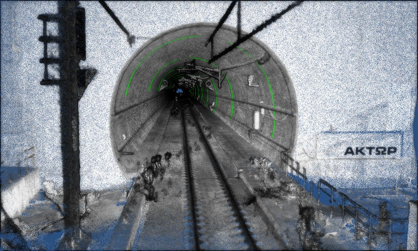
Geometric Documentation & Visual Inspection of the 10 longest Greek Railway Tunnels
Within the national project “Upgrading the Safety Infrastructure of the 10 Longest O.S.E. Railway Tunnels using Smart IoT Systems,” our team is delive...
We combine terrestrial laser scanning, mobile LiDAR and panoramic imaging to produce high-fidelity point clouds and deliver Scan-to-BIM, as-built CAD, and interactive digital twins—accessible on web viewers and integrated with GIS/BIM workflows.
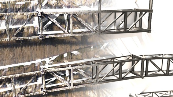
Millimeter‑accurate, noise‑filtered point clouds from terrestrial and SLAM/mobile scanning, aligned with survey control. Delivered in LAS/E57/RCP formats with QA/QC reports.
Parametric BIM models (Revit/IFC) and as‑built CAD plans, sections and elevations. Level‑of‑Detail tailored to your scope (LOD 200–400) for design, permitting and fabrication.
Photorealistic Web‑based viewers and immersive experiences (mesh/point cloud), with asset metadata, annotations and optional IoT dashboards for live monitoring.
Tunnel convergence, settlement, and structural displacement analyses from repeated scans.
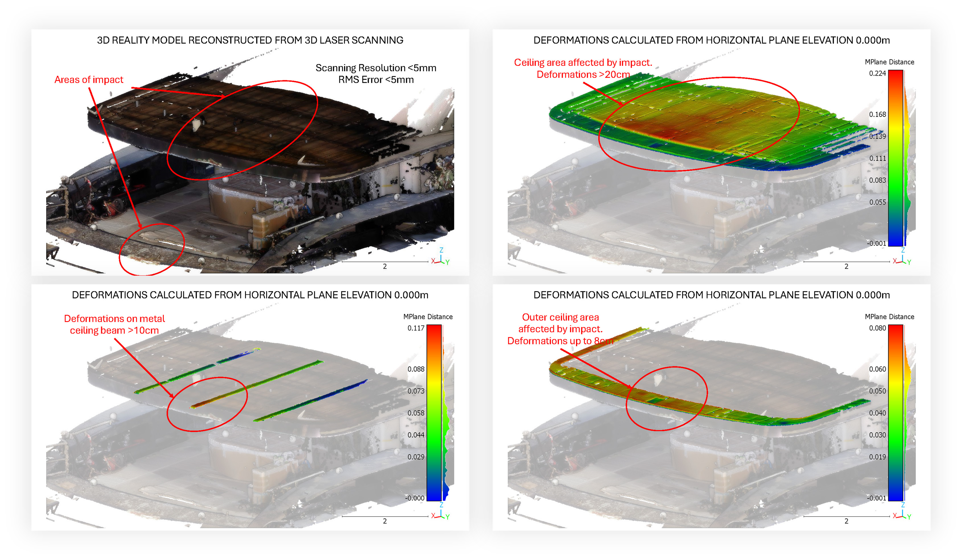
Clash detection and deviation heatmaps comparing BIM/CAD to the point cloud.
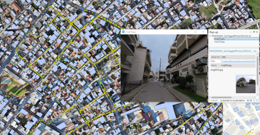
Georeferenced panoramas linked to assets, documents and tickets inside the twin.

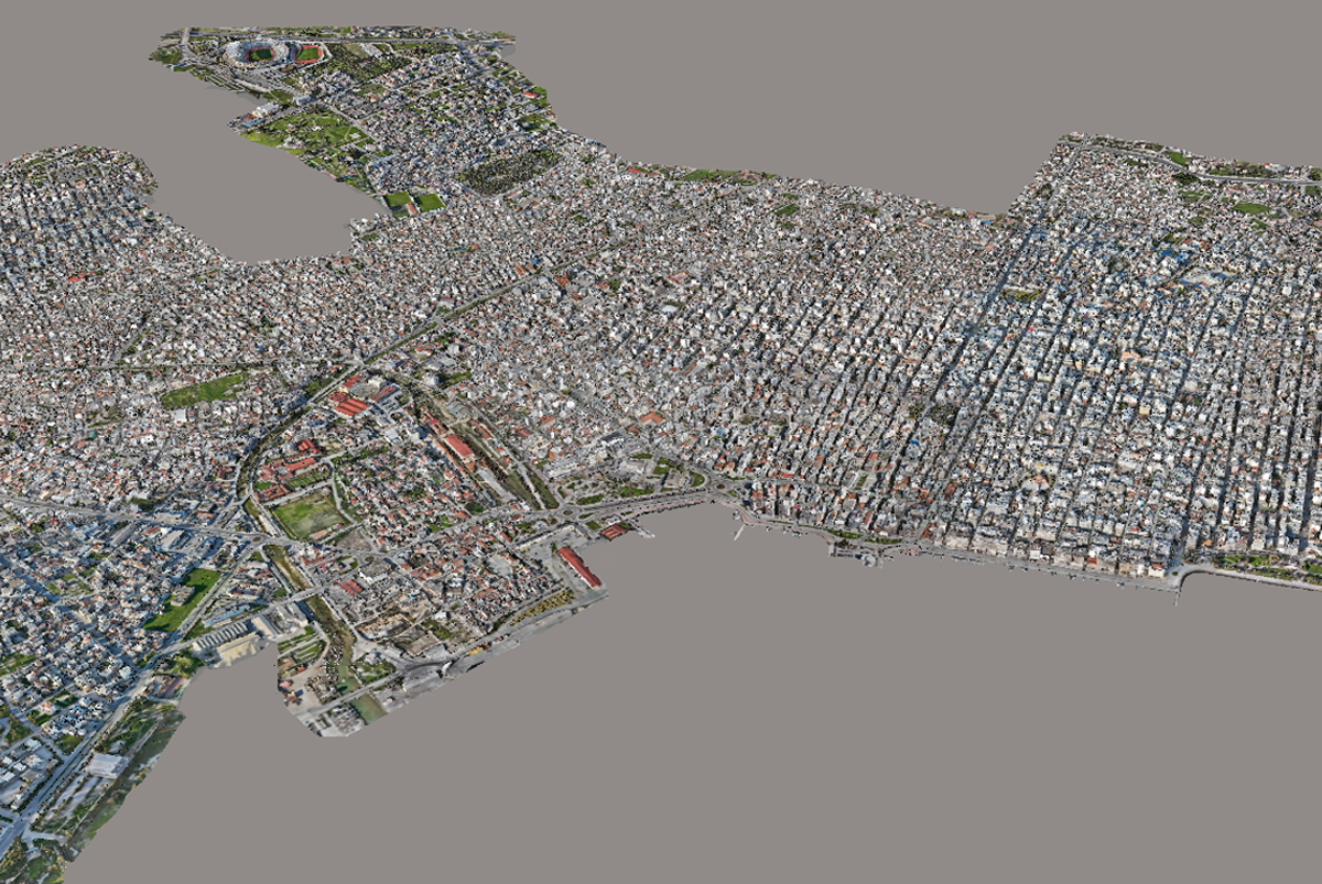
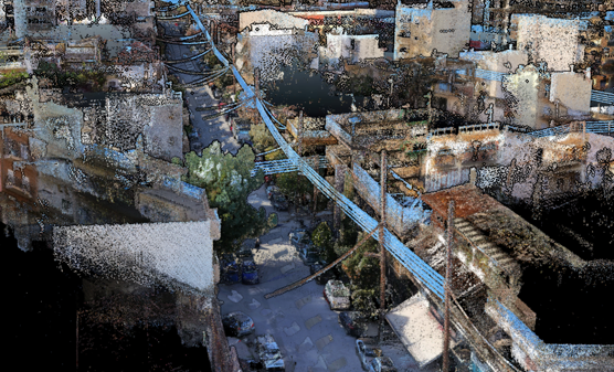
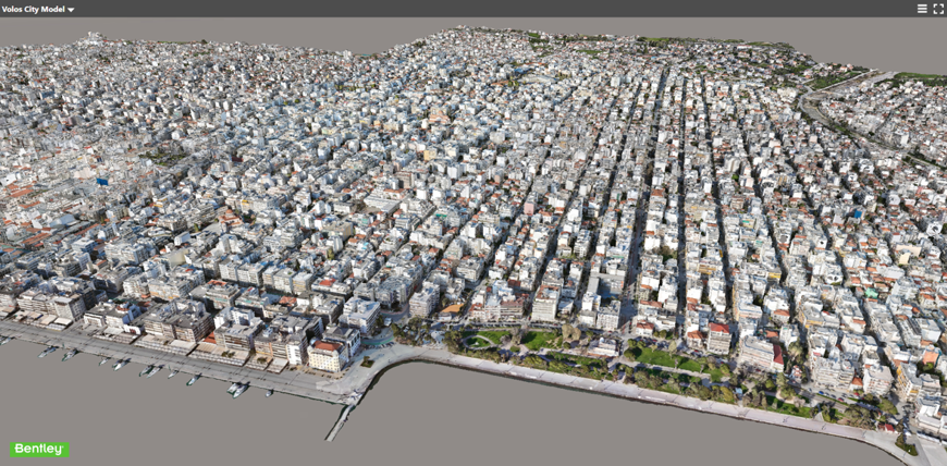
From drone survey and mobile mapping to orthophoto, terrain models and a textured 3D mesh, this Digital Twin project demonstrates our end‑to‑end workflow: flight planning, ground control/RTK, robust photogrammetric processing and delivery in GIS/CAD/BIM formats.
Control-tied scanning and rigorous QA/QC ensure dependable as-built documentation.
From capture to delivery, we optimize for speed, completeness and interoperability.
Deliverables slot into GIS/CAD/BIM—and can power web twins and dashboards.
Terrestrial, mobile/SLAM and panoramic capture tuned to the site constraints.


