LiDAR vs Photogrammetry: Which One Should You Use?
Selecting the right geospatial data-acquisition method is one of the most consequential decisions at the outset of any infrastructure, engineering, or environmental project. The two dominant technologies—LiDAR (Light Detection and Ranging) and photogrammetry—both produce high-quality 3D representations of real-world environments, yet they rely on fundamentally different physical principles, generate different data characteristics, and carry different cost and operational profiles.
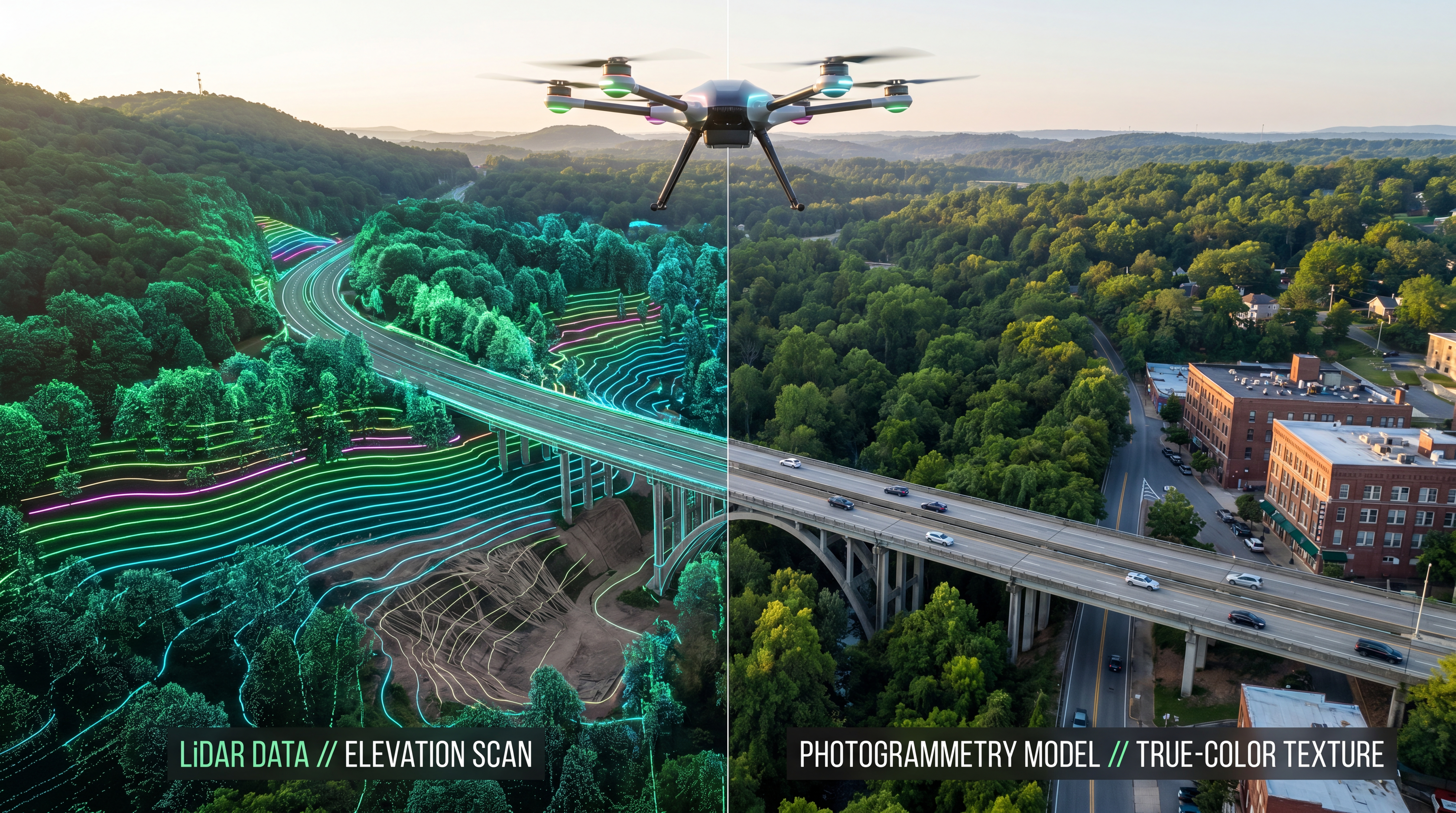
LiDAR emits active laser pulses and measures their return time to build dense point clouds, while photogrammetry derives 3D geometry from overlapping optical images through Structure from Motion (SfM) and Multi-View Stereo (MVS) algorithms. These differences have direct implications for accuracy, penetration of vegetation canopy, deliverable quality, processing requirements, and overall project economics.
This article provides a technically grounded comparison of the two methods, examines where each excels, and explains how hybrid workflows can unlock the full value of both technologies. The goal is to equip project teams with the information needed to make an informed, fit-for-purpose sensor selection decision.
What Is LiDAR?
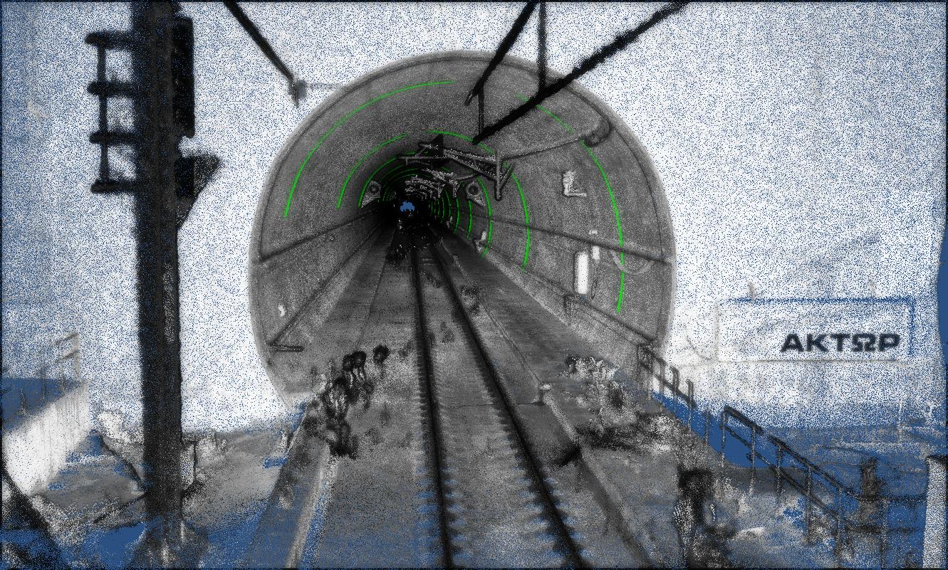
LiDAR is an active remote-sensing technology that measures distances by emitting laser pulses toward a target surface and recording the time elapsed before each pulse returns to the sensor. Modern airborne LiDAR systems emit hundreds of thousands—or millions—of pulses per second, and each return is recorded as a three-dimensional point with X, Y, Z coordinates and intensity values. The aggregate of these points forms a dense 3D point cloud.
Operating Principles
Airborne LiDAR systems typically integrate three core components: the laser scanner (emitting and receiving pulses), an Inertial Measurement Unit (IMU) that records the platform's orientation in real time, and a GNSS receiver that provides absolute positional data. The synchronized fusion of these three data streams enables each laser return to be geolocated with centimeter-level accuracy.
A key capability of LiDAR is multiple-return recording. A single emitted pulse can generate several returns as it passes through semi-transparent features such as tree canopies, power lines, or building edges. By analyzing first, intermediate, and last returns separately, analysts can distinguish above-ground features from bare-earth terrain—a process known as ground classification.
Key Characteristics
- Active sensor—operates independently of ambient lighting (day, night, overcast conditions)
- Penetrates vegetation canopy, enabling bare-earth Digital Terrain Model (DTM) extraction
- Delivers high vertical accuracy, typically ±2–15 cm depending on flight altitude and sensor grade
- Produces dense, georeferenced 3D point clouds with intensity and classification attributes
- Efficient for corridor mapping, large-area surveys, and terrain modelling under canopy
Common Deliverables
- Classified point clouds (ground, vegetation, buildings, infrastructure)
- Digital Terrain Models (DTMs)—bare-earth surface
- Digital Surface Models (DSMs)—top-of-canopy or top-of-structure surface
- Contour maps and cross-sections
- Breakline-enforced triangulated irregular networks (TINs)
What Is Photogrammetry?
Photogrammetry is a passive remote-sensing technique that reconstructs 3D geometry from overlapping two-dimensional images. When a scene is photographed from multiple vantage points with sufficient overlap (typically 70–80% forward and 60–70% side), specialized software identifies matching features across images and computes their three-dimensional positions through triangulation.
Operating Principles
Modern photogrammetric processing relies on Structure from Motion (SfM) algorithms to determine camera positions and orientations from the images themselves, followed by Multi-View Stereo (MVS) densification to generate a dense point cloud or mesh. When combined with surveyed Ground Control Points (GCPs) or direct georeferencing via RTK/PPK GNSS, the resulting models achieve centimeter-level accuracy.
Unlike LiDAR, photogrammetry produces true-color (RGB) or multispectral imagery alongside the 3D geometry. This enables the generation of photorealistic textured mesh models and geometrically corrected orthophotos—deliverables that carry rich visual and spectral information in addition to spatial accuracy.
Key Characteristics
- Passive sensor—relies on ambient light; optimal results require consistent, diffuse illumination
- Produces photorealistic, color-accurate 3D models and orthophotos
- Lower sensor and platform cost compared to LiDAR
- Cannot penetrate vegetation—models represent the visible surface only
- Processing is computationally intensive, particularly for large image sets
Common Deliverables
- Orthophotos—geometrically corrected, georeferenced aerial mosaics
- Dense image-matched point clouds
- 3D textured mesh models suitable for BIM and digital-twin integration
- Digital Surface Models (DSMs)
- Contour maps and volumetric calculations
Key Differences Between LiDAR and Photogrammetry
The following table summarizes the principal technical and operational differences between the two methods:
| Factor | LiDAR | Photogrammetry |
|---|---|---|
| Sensing Principle | Active—emitted laser pulses | Passive—reflected ambient light captured as images |
| Vertical Accuracy | Very high (±2–15 cm typical for airborne systems) | High (±3–10 cm with GCPs and RTK/PPK) |
| Vegetation Penetration | Yes—multiple returns enable bare-earth extraction | No—models the visible surface only |
| Visual / Spectral Detail | Limited—intensity values only (no color) | Excellent—true-color or multispectral imagery |
| Lighting Dependency | None—operates day, night, and overcast | High—requires consistent ambient illumination |
| Sensor / Platform Cost | Higher—specialized laser scanner and IMU | Lower—standard calibrated cameras |
| Processing Complexity | Moderate—strip adjustment and classification | High—SfM/MVS reconstruction, large image sets |
| Point Density Control | Consistent—set by pulse rate and flight parameters | Variable—depends on texture, overlap, and GSD |
When to Use LiDAR
LiDAR is the preferred sensor choice when the project demands accurate bare-earth terrain data, operation in low-light or no-light conditions, or survey of areas with dense vegetation cover.
Primary Use Cases
- Forested and densely vegetated terrain where bare-earth DTMs are required
- High-accuracy topographic surveys for civil-engineering design (road, rail, drainage)
- Flood-risk modelling and hydrological analysis requiring precise terrain representation
- Corridor mapping for transmission lines, pipelines, and transportation infrastructure
- Geotechnical and environmental baseline surveys in challenging terrain
- Mine-site and quarry surveys where pit-wall geometry and volumetric reconciliation demand high vertical precision
Why Choose LiDAR?
LiDAR's ability to record multiple returns per pulse allows it to "see through" vegetation canopy and model the underlying ground surface—a capability that photogrammetry cannot replicate. For projects where terrain accuracy beneath vegetation is a governing requirement, LiDAR is the technically appropriate choice.
When to Use Photogrammetry
Photogrammetry is the preferred method when the project requires photorealistic visual outputs, spectral information, or cost-effective acquisition over open or lightly vegetated terrain.
Primary Use Cases
- Urban and built-environment mapping where visual context is important
- Construction monitoring and as-built documentation with visual overlays
- Architectural and heritage documentation requiring textured 3D models
- Stockpile volumetrics in open quarries and construction sites
- Agricultural and environmental monitoring using multispectral imagery
- Marketing, stakeholder communication, and visual-impact assessments
Why Choose Photogrammetry?
Photogrammetry delivers true-colour, photorealistic 3D models and orthophotos that carry far more visual and spectral information than LiDAR intensity data alone. Where the project deliverable must communicate spatial context to non-specialist audiences—or where spectral analysis is required—photogrammetry is the more informative sensor choice.
Hybrid Workflows: Combining LiDAR and Photogrammetry
In many infrastructure projects, the optimal approach is not an either/or choice but a deliberate integration of both technologies. Hybrid workflows leverage the complementary strengths of each method to produce deliverables that neither technology could achieve alone.
How a Hybrid Workflow Operates
- LiDAR provides the accurate geometric framework—bare-earth terrain, canopy-penetrating point clouds, and precise breaklines
- Photogrammetry overlays photorealistic textures, true-color orthophotos, and spectral data onto the LiDAR geometry
- The combined dataset supports richer analysis, more intuitive visualization, and improved decision-making
Where Hybrid Approaches Add Value
- Digital-twin development—combining survey-grade geometry with photorealistic visual context
- Large-scale infrastructure programs requiring both terrain accuracy and visual communication
- Smart-city and urban-planning applications where spatial precision and visual realism must coexist
- Environmental assessments that require both canopy-penetrating terrain data and multispectral analysis
Accuracy Considerations
Achieved accuracy for both LiDAR and photogrammetry depends on several interdependent factors that must be managed across the full data-acquisition and processing chain:
- Sensor quality and calibration—laser scanner specification, camera calibration, IMU grade
- Flight parameters—altitude, speed, overlap (for photogrammetry), pulse rate (for LiDAR)
- Ground control strategy—number, distribution, and survey quality of GCPs and checkpoints
- Processing methodology—strip adjustment, bundle adjustment, georeferencing approach, and quality-control procedures
General Guidelines
- LiDAR delivers superior vertical accuracy and is generally the stronger choice for terrain modelling, particularly under vegetation
- Photogrammetry provides high horizontal accuracy and excels where visual quality and spectral information are important
- For both methods, achieved accuracy scales with the rigor of the ground-control strategy and processing workflow
Cost Comparison
While photogrammetry generally carries lower per-project acquisition costs due to less expensive sensor hardware, cost comparisons should be evaluated in terms of total project value rather than initial expenditure alone.
LiDAR
- Higher equipment and mobilization costs (specialized scanner, IMU, GNSS integration)
- Often faster field acquisition for large or complex sites, reducing total field time
- Processing is typically faster for terrain-focused deliverables, particularly in vegetated areas
Photogrammetry
- Lower acquisition cost—standard cameras and consumer or survey-grade UAV platforms
- Processing time increases significantly with image count and project extent
- Delivers high value-for-cost in open terrain, urban environments, and visual-output projects
The right choice depends on the project's accuracy specification, deliverable requirements, site conditions, and schedule constraints—not on sensor cost alone.
Choosing the Right Solution for Your Project
The following decision framework summarizes the key considerations:
- Do you need to map terrain beneath vegetation or tree canopy? → LiDAR
- Do you need photorealistic 3D models or true-color orthophotos? → Photogrammetry
- Is budget the primary constraint and the site is open terrain? → Photogrammetry
- Is high vertical accuracy the governing specification? → LiDAR
- Do you need both terrain accuracy and visual realism? → Hybrid approach
- Does the project require operation in low-light or night conditions? → LiDAR
- Is spectral analysis (multispectral, thermal) required? → Photogrammetry with appropriate sensor
Integrating with Modern Infrastructure Workflows
Both LiDAR and photogrammetry generate datasets that integrate seamlessly into contemporary engineering and asset-management ecosystems:
- GIS platforms — enabling spatial querying, thematic mapping, and multi-layer analysis for infrastructure planning and asset management
- BIM environments — providing survey-grade spatial baselines for design coordination, clash detection, and construction verification
- Digital twins — feeding continuously updated 3D models for real-time operational monitoring and lifecycle management
- AI and machine learning — automating feature extraction, defect classification, change detection, and predictive maintenance analytics
This integration transforms raw survey data into actionable engineering intelligence, enabling organisations to move from reactive decision-making to data-driven project governance.
Why Choose ARGO-E
ARGO-E delivers end-to-end geospatial solutions engineered specifically for infrastructure projects. Our approach spans the full data lifecycle—from sensor selection and field acquisition through processing, analysis, and integration into downstream engineering workflows.
Our Capabilities
- UAV-based LiDAR and photogrammetric survey services operated by certified remote pilots with infrastructure-sector experience
- Advanced data processing, classification, and 3D modelling using industry-standard and proprietary workflows
- Seamless integration of survey deliverables with GIS, BIM, and digital-twin environments
- Customized project workflows aligned with your accuracy specifications, schedule, and business objectives
We do not simply recommend a technology. We help you select the right solution for your specific project outcomes.
Featured Projects
|
|
|
|
|


Frequently Asked Questions
What is the main difference between LiDAR and photogrammetry?LiDAR is an active sensor that emits laser pulses to measure distances directly, producing 3D point clouds with high vertical accuracy and the ability to penetrate vegetation. Photogrammetry is a passive technique that reconstructs 3D geometry from overlapping images, delivering photorealistic models and orthophotos but limited to the visible surface.
Which method is more accurate?LiDAR generally achieves superior vertical accuracy, especially for terrain modelling under vegetation. Photogrammetry provides high horizontal accuracy and excellent visual quality. Achieved accuracy for both methods depends on sensor grade, flight parameters, ground-control strategy, and processing rigor.
Is photogrammetry sufficient for engineering projects?For many applications—including construction monitoring, volumetric calculations, and design verification in open terrain—photogrammetry provides adequate accuracy. However, projects requiring bare-earth terrain models, sub-decimeter vertical precision, or surveys under vegetation typically require LiDAR.
Can both methods be used together?Yes. Hybrid workflows that combine LiDAR's geometric precision with photogrammetry's visual richness are increasingly standard in infrastructure projects. This approach delivers the most comprehensive dataset for applications such as digital twins, large-scale design programs, and multi-disciplinary engineering analysis.
What deliverables can I expect from each method?LiDAR typically produces classified point clouds, DTMs, DSMs, contour maps, and breakline-enforced TINs. Photogrammetry delivers orthophotos, textured 3D mesh models, image-matched point clouds, DSMs, and volumetric reports. In hybrid workflows, both deliverable sets are produced and integrated.
Conclusion
LiDAR and photogrammetry are both mature, proven technologies—but they serve different purposes and excel under different conditions. LiDAR is the stronger choice where terrain accuracy, vegetation penetration, and lighting independence are critical. Photogrammetry is more appropriate where photorealistic visual outputs, spectral analysis, and cost efficiency are the governing priorities. In many cases, a deliberate hybrid approach that integrates both technologies produces the most valuable and versatile project dataset.
Selecting the right sensor—or the right combination of sensors—ensures better data quality, more confident design decisions, and stronger project outcomes across the full infrastructure lifecycle.
Not sure which method is right for your project?
Contact ARGO-E to get expert guidance and a tailored geospatial solution.