

How Drone Mapping Is Transforming Infrastructure Project Delivery
Infrastructure projects are growing in complexity, data intensity, and schedule sensitivity. Traditional ground-based surveying methods remain a foundational part of the engineer's toolkit, yet they increasingly struggle to satisfy the demands of modern project timelines, safety protocols, and spatial-data requirements.
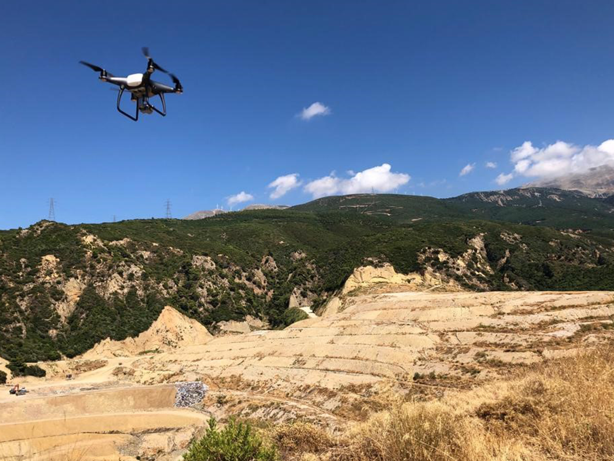
Drone mapping—also referred to as UAV (Unmanned Aerial Vehicle) surveying or UAS-based photogrammetry—has emerged as a powerful complement to conventional techniques. By deploying aerial platforms equipped with calibrated cameras, LiDAR sensors, and multi-frequency GNSS receivers, project teams can acquire dense geospatial datasets over large areas in a fraction of the time required by traditional methods.
This shift is not merely technological; it is strategic. When properly integrated into project workflows, drone mapping enables better-informed design decisions, reduced exposure to site hazards, tighter schedule control, and measurable cost efficiencies across the full infrastructure lifecycle.
What Is Drone Mapping?
Drone mapping is the process of using unmanned aerial vehicles to systematically collect geospatial data and produce accurate digital representations of real-world environments. The specific outputs depend on the sensor payload and processing methodology employed.
Data Acquisition
Depending on sensor configuration, a drone survey can capture:
- High-resolution aerial imagery (RGB and multispectral bands)
- LiDAR point clouds for detailed surface and terrain modelling
- Thermal-infrared data for structural and electrical inspections
- Multispectral data for vegetation health and environmental assessments
Processed Deliverables
Raw data is processed through photogrammetric or LiDAR-processing software to produce a range of engineering-grade deliverables:
- Orthophotos — geometrically corrected, georeferenced aerial mosaics
- Digital Elevation Models (DEMs) and Digital Surface Models (DSMs)
- 3D textured mesh models suitable for BIM and digital-twin integration
- Contour maps and volumetric calculations
- Classified point clouds for terrain, vegetation, and structure separation
Strategic Advantages of Drone Mapping
1. Speed and Operational EfficiencyA UAV survey can cover tens of hectares in a single flight session lasting one to two hours—work that would typically require a ground survey crew several days or weeks to complete. For fast-tracked infrastructure programmes where schedule compression is critical, this acceleration can directly impact project milestones and cash-flow timelines.
2. Cost ReductionDrone mapping reduces field-crew mobilisation requirements, minimises equipment hire, and shortens the overall survey delivery window. On large-scale or remote-site projects, these efficiencies compound, producing meaningful savings in both direct survey costs and downstream programme costs tied to data availability.
3. Improved Personnel SafetyDrones eliminate the need for surveyors to access hazardous or difficult-to-reach zones, including:
- Steep slopes, unstable embankments, and excavation faces
- Active construction zones with heavy plant and equipment
- High-voltage transmission corridors and energised substations
- Confined or environmentally sensitive areas
By removing personnel from these environments, project teams reduce exposure to fall hazards, struck-by incidents, and other site-specific risks.
4. High-Resolution, Survey-Grade DataModern UAV systems, when combined with properly distributed ground control points (GCPs) and RTK or PPK GNSS correction, routinely achieve horizontal and vertical accuracies at the centimetre level. Ground Sampling Distances (GSDs) of 1–3 cm per pixel are standard for infrastructure-grade surveys, enabling the extraction of detailed planimetric and elevation data from aerial imagery.
5. Repeatability and Temporal MonitoringBecause drone surveys are rapid and relatively low-cost to remobilise, they are well suited to periodic data collection. This enables construction progress tracking, earthworks volume reconciliation, deformation monitoring, and change-detection analysis across the project timeline.
Key Applications in Infrastructure
Transportation Infrastructure
- Corridor mapping for road, rail, and highway design
- Construction progress monitoring and milestone verification
- Cut-and-fill volume calculations for earthworks management
- Bridge and structural inspection using high-resolution oblique imagery
Construction
- Site planning, layout verification, and design overlay
- Periodic as-built documentation and deviation analysis
- Material stockpile volumetrics
Energy and Utilities
- Transmission and distribution line corridor inspection
- Solar-farm terrain modelling and panel-layout optimisation
- Pipeline route surveys and integrity monitoring
Mining and Quarrying
- Stockpile volume calculations for inventory reconciliation
- Pit wall stability monitoring and safety assessments
- Mine-plan compliance and operational planning support
Environmental and Urban Planning
- Land-use classification and environmental baseline surveys
- Flood-risk modelling and stormwater catchment analysis
- Urban development planning and visual-impact assessments
Drone Mapping vs. Traditional Surveying
The following table summarises the comparative characteristics of UAV-based and conventional ground-based survey methods:
| Factor | Traditional Surveying | Drone Mapping |
|---|---|---|
| Survey Speed | Days to weeks for large sites | Hours to a single day |
| Personnel Required | Full field crew on site | Pilot and observer (typically 1–2 persons) |
| Safety Exposure | Direct exposure to site hazards | Minimal; remote data acquisition |
| Spatial Coverage | Point- or line-based measurement | Continuous, area-wide coverage |
| Data Density | Discrete survey points | Dense point clouds and ortho-imagery |
| Cost Structure | Higher labour and mobilisation costs | Lower per-hectare cost at scale |
| Repeatability | Remobilisation adds cost and time | Easily repeated at low marginal cost |
It is important to note that traditional surveying remains essential for control network establishment, subsurface positioning, and tasks requiring sub-centimetre precision. Drone mapping is most effective when deployed as a complementary technology within an integrated survey strategy.
From Data Acquisition to Deliverables
A typical drone mapping workflow follows a structured sequence of phases:
Phase 1: Project Scoping and Flight Planning
- Define survey objectives, required accuracy, and deliverable specifications
- Prepare the flight plan: flight altitude, overlap settings, GCP distribution
- Obtain regulatory approvals and airspace authorisation
Phase 2: Field Operations
- Deploy and survey ground control points (GCPs) using GNSS
- Execute UAV flights according to the approved flight plan
- Perform in-field quality checks on image coverage and GCP observations
Phase 3: Data Processing
- Photogrammetric processing (Structure from Motion and Multi-View Stereo) or LiDAR point-cloud registration
- Georeferencing against GCPs; bundle adjustment and accuracy assessment
- Quality control checks: residual analysis, visual inspection, completeness review
Phase 4: Deliverable Generation
- Production of orthophotos, DEMs/DSMs, contour maps, and 3D models
- Volumetric calculations, cross-section extraction, and design overlays
- Delivery in project-specified coordinate reference systems and file formats
Phase 5: Integration and Analysis
- Integration with GIS platforms for spatial analysis and asset management
- Import into BIM environments for design coordination and clash detection
- Feeding digital-twin platforms for operational monitoring and lifecycle management
Integrating Drone Mapping with Advanced Technologies
The full value of drone-acquired data is realised when it is integrated into broader technology ecosystems:
- GIS platforms — enabling spatial querying, thematic mapping, and multi-layer analysis for infrastructure planning and asset management
- Digital twins — providing a continuously updated, survey-grade spatial baseline for real-time asset monitoring and operational decision-making
- AI and machine learning — automating feature extraction, defect classification, change detection, and predictive maintenance analytics
- Custom software platforms — embedding geospatial intelligence into project-specific workflows, dashboards, and reporting systems
This integration transforms raw survey data into actionable engineering intelligence, enabling organisations to move from reactive decision-making to data-driven project governance.
Challenges and Practical Considerations
While drone mapping offers substantial benefits, successful deployment requires careful attention to several factors:
- Regulatory compliance — national and local aviation regulations, airspace restrictions, operating licences, and site-specific flight permissions
- Environmental conditions — wind speed limitations, precipitation, lighting conditions, and their impact on data quality
- Data-processing capacity — the computational resources and specialist software required to process large photogrammetric or LiDAR datasets
- Operator competency — qualified remote pilots, experienced photogrammetrists, and engineers capable of interpreting and integrating the outputs
- Ground control strategy — the design, survey, and distribution of GCPs to achieve the target accuracy specification
Partnering with an experienced provider that combines UAV operations expertise, survey engineering knowledge, and data-processing capability is essential for consistently delivering reliable, project-grade results.
Why Choose ARGO-E for Drone Mapping
ARGO-E delivers end-to-end drone mapping solutions engineered specifically for infrastructure projects. Our approach integrates field operations, data processing, and downstream analytics into a single, quality-controlled workflow.
What Sets Us Apart
- Multidisciplinary expertise spanning geospatial engineering, data analytics, software development, and infrastructure consulting
- Advanced UAV and LiDAR platforms operated by certified remote pilots with infrastructure-sector experience
- Seamless integration of survey deliverables with GIS, BIM, and digital-twin environments
- A focus on actionable engineering intelligence—not just data delivery
We do not simply provide maps. We help you make better-informed engineering decisions, faster.
Featured Projects
|
|
|
|
|
|


Frequently Asked Questions
What is drone mapping?Drone mapping uses unmanned aerial vehicles equipped with cameras or LiDAR sensors to capture georeferenced aerial data and generate maps, 3D models, and terrain information for engineering and planning purposes.
How accurate is drone mapping?With appropriate ground control and RTK/PPK GNSS correction, drone mapping routinely achieves centimetre-level horizontal and vertical accuracy—sufficient for most infrastructure design, construction monitoring, and volumetric applications.
When should I choose drone mapping over traditional surveying?Drone mapping is particularly advantageous for large-area surveys, sites with difficult terrain or access constraints, projects requiring frequent repeat surveys, and situations where rapid data turnaround is critical. For control-network establishment and sub-centimetre tasks, traditional survey methods remain the appropriate choice. In many projects, the optimal approach combines both methods.
What deliverables can I expect from a drone survey?Typical deliverables include orthophotos, digital elevation models, 3D mesh models, contour maps, volumetric reports, and classified point clouds. All outputs are delivered in the coordinate reference system and file formats specified by the project.
Conclusion
Drone mapping has matured from an emerging technology into a core capability in modern infrastructure project delivery. By delivering faster surveys, safer field operations, and richer spatial datasets, it enables project teams to work with greater efficiency and confidence.
As the infrastructure sector becomes increasingly data-driven, organisations that integrate drone mapping into their survey and design workflows will be better positioned to manage project risk, control costs, and deliver superior outcomes.
Ready to integrate drone mapping into your projects?
Contact ARGO-E to discuss how our UAV and geospatial engineering solutions can support your next infrastructure project.